For any queries or comment about this page please contact
David N Williams at pondside@talktalk.net
CLIMATE
Global Water Distribution
Oceans and Seas Ice Caps Lakes, Rivers, Ground, Atmosphere
97% 2% 1%
1% is constantly recycled, and the water in the atmosphere equals approx 10 days normal rainfall.
Rainfall, constitutes the major part of water supply. The local geology determines how accessible this rainfall becomes. Average rainfall for Langford in Essex is low at 22 inches (550mm) per annum
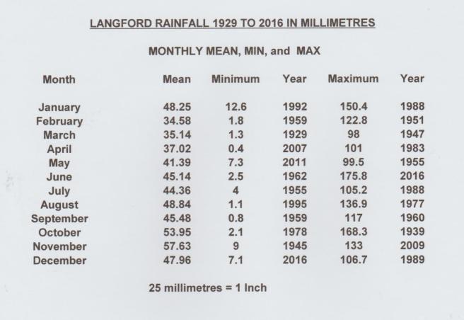
Monthly Rainfall Statistics From Langford Treatment Plant

Winter Summer Average
Above Black line % available in Rivers
Percentage Rainfall Distribution
Following a period of rainfall, there is large variation in run off from the land, usually depending upon the season, and how dry the soil is. During summer months during dry conditions, the soil can absorb large quantities of water, which is subsequently returned to the atmosphere by evaporation. In winter when the soil is saturated, most of the rainfall flows directly towards the rivers or underground strata.
Geology
Essex Geology
As you dig down into the ground over most of Essex you first encounter shallow patches of glacial gravel which can supply the shallow wells. Where there is no glacial gravel to supply wells, in the early days people relied upon collecting rainwater from roofs, and streams upon the clay bed. Underneath these there is the impervious London Clay up to 530 ft thick. Then comes beds of water bearing sand or sandy clay up to 100 ft thick, and finally deep water bearing chalk beds up to 890 ft thick. Water from the sand and chalk being similar as it flows between the two.

Strata Map of Essex
The Chalk exists submerged over the majority of Essex with only a small area found at the surface, in South Essex at Grays and a belt in the north of the county, near Saffron Walden, where the London Clay ends. The surface of the chalk dips towards the south of the county and is 600 ft below ground level at Southend. The thickness of the chalk varies with the thickest part of 890 ft found at Harwich in the East, and 647 ft at East Ham in the West.
The chalk was deposited, between 200 to 100 million years ago, when Southern England was submerged under a tropical sea. It consists predominantly of the micro skeletons of Coccoliths, some tenth of a millimetre in diameter, only visible through an electron microscope. These were aquatic algae that proliferated in the sea, some of which can be found today. As the sea level fell, most of Essex became a tropical marsh fed by the Rivers Thames and Medway from the West. These carried the silt that formed the Clay in the London Basin, prior to discharging into the North Sea.


Coccolith chalk skeleton 0.1 mm diameter , and clump of coccoliths

Pre Ice Age course of the Rivers Thames andMedway
There are opinions that the River Thames entered the North Sea further to the North than the above diagram, at Happisburgh, North East of Norwich, in Norfolk.
Chemicals in the London Clay such as Calcium Sulphate increase the permanent hardness of water and have the potential under anaerobic bacteriological conditions to corrode cast iron mains externally. To prevent this a small charge can be applied to the main, this is called Cathodic protection.

Failed Glassfibre main in thick clay DNW Photo
Organic chemicals in the internal gel coat of glass fibre mains also render them unsuitable for water supply due to supporting high bacterial growths.

The sand and gravel beds occur in irregular isolated patches over Essex, and were very important as often being the only source from which a local water supply could be obtained, prior to the advent of pumps allowing water to be raised from deep wells and boreholes in the chalk, below the clay. Interestingly, where the water was obtained from pockets of gravel in the clay the water was found to be hard, dissolved from minerals in the clay. Unlike that obtained from above the clay, where the water had not permeated the clay first, and the water is soft. However dissolved Carbon dioxide results in an acidic water agresive to copper and lead pipes.
The borehole water in the general area bounded by Maldon, Chelmsford, Mountnessing and Basildon is naturally softened, by passing though an area of the Thanet sands, containing dolomite, which lie between the clay and chalk. The calcium and magnesium are replaced by sodium, an action similar to a domestic water softener. Areas of these sands are also high in Fluoride ( see Maldon Borough)
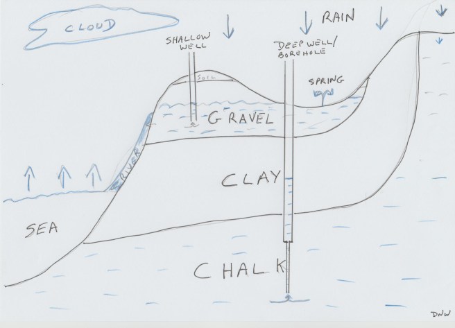
Water bearing Gravel and Chalk strata
Effect of Earthquakes on Springs
Earthquakes have modified the flow of springs temporarily or permanently causing some to cease flowing, as in the Essex earthquake on 22nd April 1884. At the Eagle Brewery in Colchester, in a chalk well, the level, normally 22 feet below ground level rose 4 ft for a period of four months. At the Colchester Waterworks the level rose 7 feet above normal for about 6 months, and at Bocking the rise in level was 18 inches. In some places wells became discoloured with a reddish sand for a short period, and some temporary springs appeared. The most remarkable, was turbid water appearing from a 600 ft deep well at Canterbury. The Water Tower at Colchester, holding 250,000 gallons was seen to oscillate, and became slightly cracked.
Over parts of England, such as Cornwall, one finds large formations of Granite formed by the cooling of igneous material, which is impervious to water and just bears streams formed from rainwater. Some of this is radioactive and houses built on it have special foundations to prevent the radiation from permeating constantly into the houses. This was formed millions of years ago, and my kitchen worktop is an Indian granite 400 million years old and I hope not too radioactive. The different minerals can be clearly seen together with the semi precious stones.

Indian Granite 400 million years old showing mineral striations. I hope it is not radio active, as I have a third of a ton in my kitchen worktop !!!
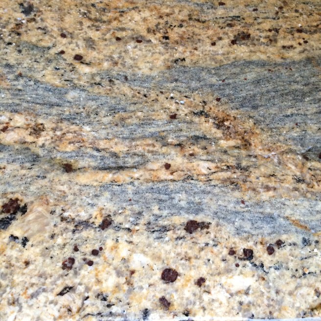
Granite close up showing red agates
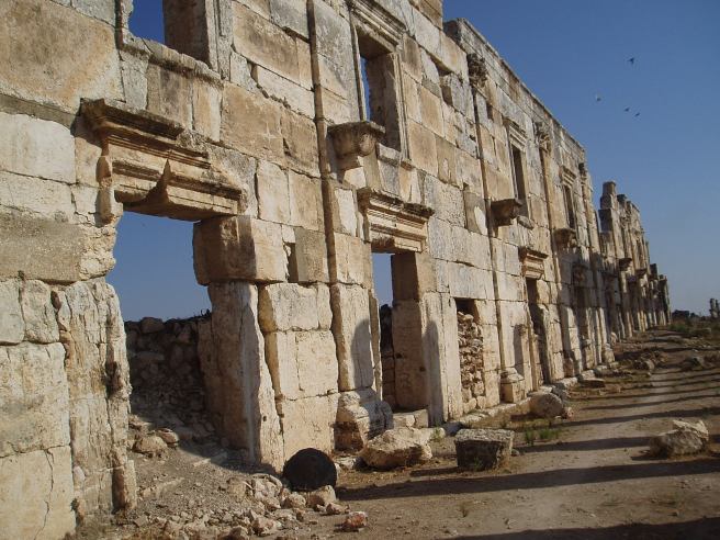
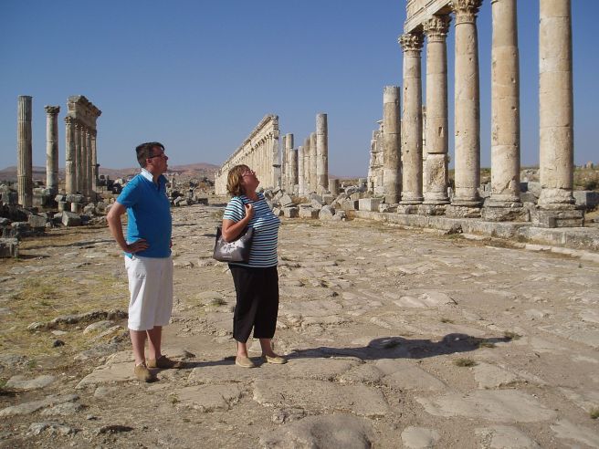
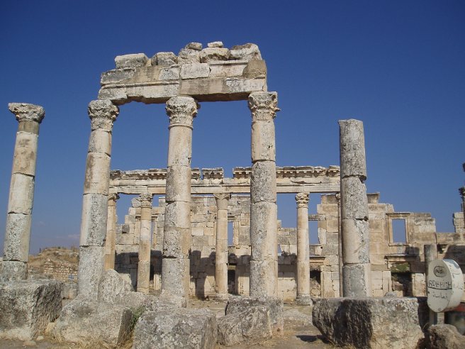
SYRIAN DESERT
The pictures below were taken in Syria in 2009 prior to the occupation and destruction of part of the Palmyra Roman historical site. Following initial destruction by the terrorists the site was taken back by the Syrian Authorities but sadly by January 2017 was back in terrorist hands.
I have included below, a few pictures of structures that are now likely to have been demolished
Some deserts have water just below the surface as in Syria, places like Palmyra were built around an Oasis. Palmyra being founded around 2000 BC became Roman in around 250 AD. The Bagdad Cafe was in the desert a short distance from Palmyra, with water pumped by a wind pump from a shallow well some 3ft deep. The only neighbours were in tents close by with petrol generators for power. There were very many camels of different colours.

Bagdad Cafe, in Syrian Desert DNW Photo 
Bagdad Cafe Neighbours DNW Photo


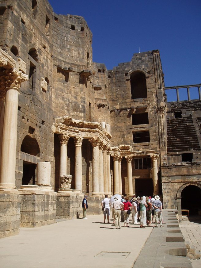

THE ONCE PEACEFUL ALLEPO
JORDAN
There are some anomalous wells such as that on the Egyptian, Pharaoh’s Island in the Red Sea between Jordan and Israel. I could not determine how deep this well was but was, assured that the water had a different analysis to the Red Sea.


Dead Sea
Some bodies of water, like the Oceans and Seas contain high levels of dissolved solids such as the Dead Sea, which is the lowest inland body of water at some 427 mts below sea level. It contains a mixture of chemicals and the water is extracted from the dead sea to extract these. The Rocks in the vicinity of the dead sea such as at Petra show the chemical strata quite clearly. The level of the dead sea is steadily dropping due to the chemical extraction. There are plans for canals to be built to raise the level, one from the Red Sea and one from the the Meditteranean but this has yet to happen as Jordan is a poor country.

Chemical Deposit on shore of Misty Dead Sea

![]()
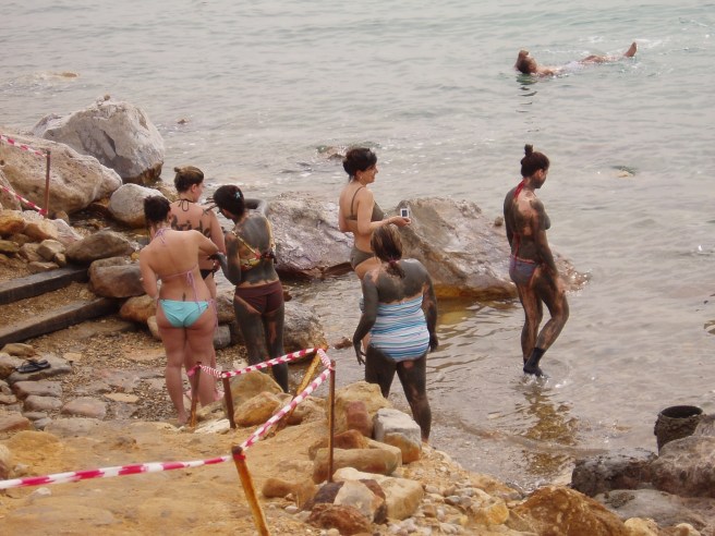
Alledged Healthy Chemical Mud DNW Photo

FLOATING IN THE DEAD SEA DNW Photo
The high concentration of dissolved chemicals make it easy to float on the Dead Sea
PETRA


Narrow Entrance to the Petra Site DNW
The Library Revealed


Fossilised bone in rock Petra entrance DNW Photo
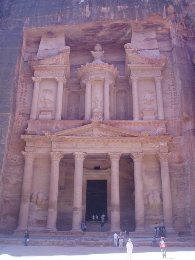

The Library, Petra DNW Photos
The Library, this magnificent carving from the rock, carved top down, as near by unfinished carvings have illustrated. Note footholds at each side. This site dates from the 1st century BC. This is only a small part of the site which includes an amphitheatre and Cave Dwellings amongst other things.

Only current visible water at Petra DNW Photo
The only visible water supply is for Petra, which may have had a substantial population, is a small stream. The Nabataeans who created the site, followed by the Romans who built an amphitheatre and buildings with Mosaics.
There was a system of channels and cisterns that collected water from the top of the surrounding rocks and supplied some 12 million gallons a day to the population
Apart from the Famous Library there is also remains of Cave Houses, Roman Buildings and Roman Mosaics leading out to the plain from the narrow entrance Gorge See Below


Original Mosaics at Petra

Whilst staying at the Movenpick Hotel, Aqaba, one evening we were relaxing with a beer, whilst a lady played the piano. I asked the waitress if the pianist played requests? She replied “the lady only plays the Piano, but there is a Belly Dancer downstairs !!!!

Hotel Movenpick Breakfast on the terrace
REMEMBER WATER AID
